I had made add a line layer using cesium. In which i had added a terrain effect using the standard cesium terrain provider as below
var dataSource1 = new Cesium.GeoJsonDataSource(); var roads = dataSource1.load('../../SampleData/roads.geojson'); roads.then(function(dataSource1) { viewer.dataSources.add(dataSource1); viewer.zoomTo(dataSource1); //Get the array of entities var entities1 = dataSource1.entities.values; var colorHash = {}; for (var i = 0; i < entities1.length; i++) { //For each entity, create a random color based on the state name. //Some states have multiple entities, so we store the color in a //hash so that we use the same color for the entire state. var entity = entities1[i]; var name = entity.name; var color = colorHash[name]; if (!color) { color = Cesium.Color.BLACK; colorHash[name] = color; } //Set the polygon material to our random color. entity.polyline.material = color; //Remove the outlines. entity.polyline.outline = false; } }).otherwise(function(error){ //Display any errrors encountered while loading. window.alert(error); }); After adding the terrain, my geojson line layer seems to be floated and shifted as below 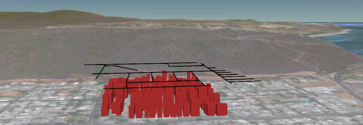
I would like to know how to avoid this floating effect of line layer alone after adding the terrain.