
Category:Maps of Israel
Wikimedia category | |||||
| Upload media | |||||
| Instance of | |||||
|---|---|---|---|---|---|
| Category combines topics | |||||
 | |||||

Subcategories
This category has the following 45 subcategories, out of 45 total.
*
- Maps of Makhtesh Ramon (7 F)
- Maps of Naharayim (9 F)
+
-
A
B
- Maps of borders of Israel (10 F)
C
- CIA maps of Israel (6 F)
D
E
- Economic maps of Israel (6 F)
F
G
- Geological maps of Israel (14 F)
H
L
M
- Military maps of Israel (31 F)
O
P
R
S
- Sports maps of Israel (5 F)
T
W
Pages in category "Maps of Israel"
The following 2 pages are in this category, out of 2 total.
Media in category "Maps of Israel"
The following 200 files are in this category, out of 335 total.
(previous page) (next page)-
 111137 acre - map of the old city PikiWiki Israel.jpg 2,841 × 2,769; 2.03 MB
-
 111785 map of the tent road in ramat negev PikiWiki Israel.png 828 × 1,792; 1.26 MB
-
.jpg/120px-1975_Israel_(30848924286).jpg) 1975 Israel (30848924286).jpg 1,302 × 1,748; 1.63 MB
1975 Israel (30848924286).jpg 1,302 × 1,748; 1.63 MB
-
 2 digit postcode israel.png 885 × 885; 118 KB
-
 20161205 DailyMap Israel ForestFire.pdf 1,754 × 1,239; 672 KB
-
.svg/120px-2026_Lebanon_War_Map_(February-Present).svg.png) 2026 Lebanon War Map (February-Present).svg 6,665 × 6,682; 9.82 MB
2026 Lebanon War Map (February-Present).svg 6,665 × 6,682; 9.82 MB
-
 2026 Lebanon War Map.svg 6,665 × 6,682; 9.84 MB
-
 6DayWarEnglish.png 4,000 × 6,900; 477 KB
-
 7 State Proposal Plan for Peace in Israel.svg 414 × 1,076; 26 KB
-
 800px-Arab-Israeli Map2.png 800 × 455; 39 KB
-
 94421 water pipe to the negev PikiWiki Israel.jpg 4,000 × 2,252; 781 KB
-
 Abda map.png 322 × 598; 39 KB
-
 Abu Ghosh 1944.jpg 975 × 465; 327 KB
-
 After war-ger.JPG 387 × 599; 33 KB
-
 Arab population israel 2000-ar.png 692 × 1,575; 142 KB
-
.jpg/120px-Area_of_Yarkon_Park_within_the_Palestine_Index_to_Villages_and_Settlements,_showing_Land_in_Jewish_Possession_as_at_31.12.44_(cropped).jpg)
-
 Arrow coverage.png 513 × 1,329; 322 KB
-
 ArtufHavtuv.png 826 × 906; 46 KB
-
 Asendi kaart Iisrael.png 188 × 467; 72 KB
-
 BaaleiMelaha.jpg 615 × 593; 118 KB
-
 Bedouin cities.jpg 1,213 × 960; 469 KB
-
 Beit Shemesh.png 1,118 × 1,270; 143 KB
-
 Ben Gurion Canal topographic map.webp 614 × 1,141; 505 KB
-
.png/60px-Blank_map_of_the_Arab_State_(1947).png) Blank map of the Arab State (1947).png 330 × 715; 4 KB
Blank map of the Arab State (1947).png 330 × 715; 4 KB
-
 Borders of Israel.png 254 × 607; 10 KB
-
 British Consulate of Jerusalem 1907.jpg 416 × 693; 39 KB
-
 Caliph Abu Bakr's empire at its peak2-mohammad adil rais.PNG 1,196 × 580; 44 KB
-
.jpg/120px-Camp_davideko_hitzarmenak_(1979).jpg) Camp davideko hitzarmenak (1979).jpg 564 × 848; 92 KB
Camp davideko hitzarmenak (1979).jpg 564 × 848; 92 KB
-
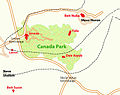 CanadaParkCropped.jpg 828 × 656; 92 KB
-
 Central-IL WB Gaza map 2.png 780 × 970; 213 KB
-
 Central-IL WB Gaza map 3 v2.png 780 × 970; 155 KB
-
 Central-IL WB Gaza map 3.png 780 × 970; 214 KB
-
 Central-IL WB Gaza map.png 780 × 970; 209 KB
-
 Cisjordan corpus findspots.jpg 799 × 803; 177 KB
-
 Civitas Iherusalem 1486.jpg 5,036 × 1,128; 714 KB
-
 Cliff hazinnim map.JPG 3,648 × 2,736; 1.42 MB
-
 Collective mental maps israel 1979.jpg 778 × 1,544; 152 KB
-
 DarcaSchoolMap .jpg 1,496 × 3,508; 315 KB
-
 DarcaSchoolMapNEW .jpg 1,496 × 3,508; 343 KB
-

-
 Districtos de Israel in interlingua.jpg 1,200 × 2,230; 180 KB
-
 Division of the Palestinian Occupied Territories after Taba.png 829 × 1,197; 461 KB
-
 ECDM 20131216 MiddleEast SevereWeather.pdf 1,625 × 1,125; 523 KB
-
 ECDM 20140717 World Events.pdf 1,625 × 1,125; 383 KB
-
 ECDM 20140804 World Events.pdf 1,625 × 1,125; 434 KB
-
 ECDM 20140806 World Events.pdf 1,625 × 1,125; 424 KB
-
 ECDM 20161125 Israel FF.pdf 1,625 × 1,125; 582 KB
-
 ECDM 20190528 Israel Forestfires.pdf 2,479 × 1,754; 868 KB
-
 ECDM 20240411 DM UCPM EU humanitarian aid response.pdf 1,350 × 1,625; 633 KB
-
 ECHO Israel Editable A4 Portrait.pdf 1,239 × 1,754; 722 KB
-
 Eco park glilot map.jpg 443 × 489; 53 KB
-
 ETH-BIB-Palästina, Höhenschichten-Dia 247-Z-00192.tif 2,891 × 3,398; 28.25 MB
-
 ETH-BIB-Palästina, Karte der jüdischen Ackerbau-Kolonien-Dia 247-Z-00173.tif 2,901 × 3,416; 28.48 MB
-
 ETH-BIB-Palästina, Karte-Dia 247-Z-00169.tif 2,868 × 3,192; 8.84 MB
-
 ETH-BIB-Palästina-Karte-Dia 247-F-00779.tif 2,986 × 3,334; 9.59 MB
-
 FLII Israel.png 704 × 883; 60 KB
-
 Fridel atlas.jpg 720 × 581; 385 KB
-
 Gaza conflict map Arabic.png 1,272 × 621; 325 KB
-
 Gaza conflict map.png 612 × 300; 27 KB
-
 Gaza conflict map2.png 595 × 365; 108 KB
-
 Gazastreifen Raketenreichweiten.png 1,200 × 2,019; 546 KB
-
 Geographic area codes of Israel.jpg 247 × 600; 54 KB
-
 Geography-of-west-bank1.gif 386 × 359; 93 KB
-
 Geopolitica israel.jpg 472 × 354; 30 KB
-
 Golan location map 3.PNG 925 × 739; 146 KB
-
 GolanHeightsMap.png 415 × 354; 29 KB
-
 Greater Israel map.jpg 1,109 × 656; 157 KB
-
 Greater Israel Map.png 892 × 1,346; 500 KB
-
 GreenLine1967-1969.png 1,818 × 2,978; 2.14 MB
-
 Gush Dan Map.svg 584 × 728; 14.45 MB
-
 Gush Dan.png 722 × 1,110; 90 KB
-
 Gush-Dan.png 722 × 1,110; 41 KB
-
 Hasmonean Kingdom Take 2.png 328 × 593; 43 KB
-
 Hasmonean Kingdom.png 328 × 593; 53 KB
-
 IDF Territorial Command.jpg 372 × 809; 61 KB
-
 Incense Route - Desert Cities in the Negev.jpg 621 × 1,030; 132 KB
-

-
 Invasion of Lebanon 2026.png 1,920 × 1,080; 1,021 KB
-
.png/120px-Israel_(+_Area_C).png) Israel (+ Area C).png 461 × 856; 61 KB
Israel (+ Area C).png 461 × 856; 61 KB
-
.png/120px-Israel_(centered_orthographic_projection).png) Israel (centered orthographic projection).png 1,280 × 1,280; 506 KB
Israel (centered orthographic projection).png 1,280 × 1,280; 506 KB
-
.png/120px-Israel_(Samaria).png) Israel (Samaria).png 800 × 995; 125 KB
Israel (Samaria).png 800 × 995; 125 KB
-
.jpg/120px-Israel_-_DPLA_-_bd7ea5281e38073505d14a5361bee6a0_(page_2).jpg) Israel - DPLA - bd7ea5281e38073505d14a5361bee6a0 (page 2).jpg 2,554 × 3,282; 5.7 MB
Israel - DPLA - bd7ea5281e38073505d14a5361bee6a0 (page 2).jpg 2,554 × 3,282; 5.7 MB
-
 Israel 2004.png 700 × 1,506; 34 KB
-
 Israel 2020 Maps.jpg 1,552 × 2,114; 576 KB
-
 Israel adm location map.png 2,000 × 3,714; 707 KB
-
 Israel Agriculture Crop Areas 2017.png 2,506 × 6,819; 9.1 MB
-
 Israel Agriculture Crop Types 2017.png 2,485 × 6,833; 8.35 MB
-
 Israel als.Wikipedia Location Map.jpg 476 × 884; 130 KB
-
 Israel and its surroundings.png 800 × 400; 162 KB
-
 Israel and Neighboring States - DPLA - 187c5775098eb2363c21e7488424333e.jpg 2,550 × 3,266; 4.34 MB
-
 Israel and occupied territories map.png 1,428 × 2,289; 266 KB
-
.png/120px-Israel_and_the_Disputed_Territories_map_(cropped).png) Israel and the Disputed Territories map (cropped).png 1,350 × 1,317; 908 KB
Israel and the Disputed Territories map (cropped).png 1,350 × 1,317; 908 KB
-
 Israel and the Disputed Territories map.png 1,350 × 2,300; 1.39 MB
-
 Israel at night.jpg 425 × 934; 174 KB
-
.png/120px-Israel_Blank_Map_(de_facto_borders).png) Israel Blank Map (de facto borders).png 1,812 × 2,209; 344 KB
Israel Blank Map (de facto borders).png 1,812 × 2,209; 344 KB
-
 Israel de facto territories.png 1,428 × 2,289; 703 KB
-
.svg/60px-Israel_dialing_codes_(en).svg.png) Israel dialing codes (en).svg 280 × 680; 41 KB
Israel dialing codes (en).svg 280 × 680; 41 KB
-
 Israel disputed w1 countrymap.svg 1,000 × 1,000; 15 KB
-
 Israel district map.svg 512 × 1,433; 14 KB
-
 Israel Drainage divide.jpg 249 × 598; 15 KB
-
 Israel green lines.png 230 × 719; 34 KB
-
 Israel labeled occupied.png 685 × 953; 145 KB
-
 Israel labeled1.png 750 × 1,043; 284 KB
-
 Israel labeled2.png 685 × 953; 164 KB
-
 Israel Libano pt.jpg 369 × 456; 50 KB
-
 Israel Linea verde.png 191 × 597; 26 KB
-
 Israel location map Sights.PNG 500 × 929; 71 KB
-
 Israel Map by The Legal Status of The Territories-4.png 800 × 400; 101 KB
-
 Israel map Hebrew WV he.png 1,308 × 1,708; 414 KB
-
 Israel map of Köppen classification.png 589 × 800; 70 KB
-
 Israel Map, Status of The Territories.png 800 × 401; 74 KB
-
 Israel map2.png 304 × 816; 22 KB
-
 Israel mapLLBG.png 279 × 339; 19 KB
-
 Israel north dms.png 250 × 250; 12 KB
-
 Israel outline northwest negev.png 844 × 471; 68 KB
-
 Israel outline shomron.png 665 × 405; 59 KB
-
 Israel outline.png 480 × 1,026; 91 KB
-
 Israel road-network-overlay.png 1,689 × 3,138; 184 KB
-
 Israel telegraph map.png 428 × 542; 229 KB
-
 Israel topo blank.jpg 1,200 × 2,013; 708 KB
-
 Israel topo de.jpg 1,200 × 2,013; 756 KB
-
 Israel topo uk.png 469 × 1,162; 921 KB
-
 Israel Topography.png 1,223 × 2,409; 4.18 MB
-
 Israel with occupied territories 02.gif 254 × 607; 9 KB
-
 Israel with occupied territories.gif 254 × 607; 9 KB
-
 Israel – U.S. area comparison.jpg 701 × 851; 363 KB
-
 Israel's loss of land 1920 - 2012.jpg 1,060 × 616; 165 KB
-
 Israel-Egypt border 1.JPG 276 × 598; 23 KB
-
 Israel-locator.PNG 330 × 715; 5 KB
-
 Israel-war-Oct-8-2023.png 528 × 468; 61 KB
-
 Israel. LOC 2001626219.jpg 2,525 × 3,265; 760 KB
-
 Israel. LOC 2001626219.tif 2,525 × 3,265; 23.59 MB
-
 Israel. LOC 2001626220.jpg 2,539 × 3,266; 829 KB
-
 Israel. LOC 2001626220.tif 2,539 × 3,266; 23.72 MB
-
 Israel. LOC 2001626225.jpg 3,144 × 4,142; 1.91 MB
-
 Israel. LOC 2001626225.tif 3,144 × 4,142; 37.26 MB
-
 Israel. LOC 2005631060.tif 4,003 × 7,595; 86.98 MB
-
 Israel.gif 254 × 607; 8 KB
-
 Israel1967.png 400 × 600; 39 KB
-
 Israel5Juin1967.png 400 × 600; 32 KB
-
 IsraelCVFRutm.jpg 999 × 1,832; 1.73 MB
-
 IsraelFinal1.png 2,106 × 2,966; 5.9 MB
-
 Israeli after 1948 war.png 320 × 897; 43 KB
-
 Israeli Coastal Plain region in Israel.png 613 × 1,140; 84 KB
-
 Israeli settlements in the Golan Heights, February 1992. LOC 92682948.jpg 2,517 × 3,263; 991 KB
-
 Israeli settlements in the Golan Heights, February 1992. LOC 92682948.tif 2,517 × 3,263; 23.5 MB
-
 Israeli-controlled territories.png 1,998 × 3,712; 518 KB
-
 Israelmaphonorthekingnew.png 223 × 599; 31 KB
-
 Israelmappng.png 304 × 816; 38 KB
-
 IsraelOMC.png 496 × 1,301; 32 KB
-
 IsraelRough.jpg 1,434 × 1,831; 462 KB
-
 Israels Friedensangebot 1967 an Syrien und Ägypten.png 1,350 × 2,029; 211 KB
-
 IsraëlCitiesBlank.png 1,000 × 2,681; 102 KB
-
 Itzhak kutner, landscape design for Bet Berl, Zofit. Israel Oct, 1948.jpg 4,960 × 6,046; 2.09 MB
-
 Izrael kmeny.jpg 391 × 460; 212 KB
-
 Izrael térkép Farkas József művéből.jpg 1,944 × 3,106; 1.82 MB
-
 Jerusalem map Green Line.png 328 × 370; 35 KB
-
 Jerusalem map Green Line2.png 328 × 370; 37 KB
-
 Jewish War campaign - North - 67 CE topographic map.jpg 2,530 × 1,760; 779 KB
-
 Jewish War campaign - South - 68 CE topographic map.jpg 2,992 × 1,857; 1.07 MB
-
 Judaean Desert.png 1,000 × 1,859; 138 KB
-
 Kaart Israël.png 330 × 715; 21 KB
-
 Kavk10.png 742 × 424; 757 KB
-
 KefarNizahon.jpg 1,067 × 490; 177 KB
-
 Kibbutzim Memorial - Memorial to Fallen Kibbutz Members P1180614.JPG 3,000 × 4,000; 4.06 MB
-
.svg/120px-Kingdom_of_Israel_(8th_century_BCE).svg.png) Kingdom of Israel (8th century BCE).svg 2,369 × 3,070; 990 KB
Kingdom of Israel (8th century BCE).svg 2,369 × 3,070; 990 KB
-
.svg/120px-Kingdom_of_Judah_(8th_century_BCE).svg.png) Kingdom of Judah (8th century BCE).svg 2,369 × 3,070; 989 KB
Kingdom of Judah (8th century BCE).svg 2,369 × 3,070; 989 KB
-
.svg/120px-Kingdoms_of_Israel_and_Judah_(8th_century_BCE).svg.png) Kingdoms of Israel and Judah (8th century BCE).svg 2,369 × 3,070; 993 KB
Kingdoms of Israel and Judah (8th century BCE).svg 2,369 × 3,070; 993 KB
-
 KiryatGat.png 877 × 701; 28 KB
-
 Kvish4.png 247 × 600; 20 KB
-
 Lage Adasiyyah im Heligen Land.jpg 502 × 713; 104 KB
-
 Lagrange - Synopse des quatre Evangiles - géographie des évangiles.jpg 805 × 1,389; 272 KB
-
 Latrun Salient.png 2,360 × 2,814; 778 KB
-
 Laxisjmap.png 2,055 × 1,738; 552 KB
-
 Maabarot map.png 916 × 2,578; 113 KB
-
 Maabarot1 map.png 912 × 1,567; 113 KB
-
 Map israel.jpg 300 × 650; 37 KB
-
 Map of administrative regions in Israel.png 2,145 × 4,107; 1.66 MB
-
.svg/60px-Map_of_Israel_(shaded_West_Bank).svg.png) Map of Israel (shaded West Bank).svg 577 × 1,600; 139 KB
Map of Israel (shaded West Bank).svg 577 × 1,600; 139 KB
-
 Map of Israel copy.png 216 × 598; 11 KB
-
 Map of Israel, neighbours and occupied territories-en.png 1,428 × 2,289; 259 KB
-
 Map of Israel, neighbours and occupied territories-V3-ar.png 1,428 × 2,289; 737 KB
-
 Map of Israel, neighbours and occupied territories-V3-en.png 1,428 × 2,289; 259 KB
-
 Map of Israeli regions and subregions-1603796740937.png 1,080 × 1,594; 115 KB
-
 Map of wind power in Israel.jpg 1,921 × 3,568; 3.68 MB
-
 Map-israel.JPG 800 × 400; 131 KB
-
 Map. Silverhoard.jpg 1,433 × 1,839; 767 KB
-
 Map471osm.png 1,118 × 275; 265 KB
-
 Mapa de Cisjordània.png 575 × 600; 150 KB
-
 Mapa do Plano de Paz de Trump.jpg 933 × 1,534; 389 KB
-
 Mapisrael2.jpg 800 × 400; 132 KB
-
 Mapo Bahaaj Pilgrimejoj.JPG 368 × 464; 21 KB
-
 Mapofisrael.JPG 800 × 401; 37 KB
-
 Mapofisrarel1.PNG 813 × 457; 77 KB
-
 Maps in Wolfson Medical Center, February 2024 01.jpg 2,604 × 1,649; 1.78 MB
-
 Maps in Wolfson Medical Center, February 2024 02.jpg 4,000 × 2,248; 2.89 MB
-
 Maps in Wolfson Medical Center, February 2024 03.jpg 4,000 × 2,248; 3.11 MB
-
 Maps in Wolfson Medical Center, February 2024 04.jpg 3,337 × 2,056; 2.34 MB
-
 Maps in Wolfson Medical Center, February 2024 05.jpg 4,000 × 2,248; 3.73 MB
-
 Maps in Wolfson Medical Center, February 2024 06.jpg 2,604 × 1,649; 1.14 MB


