
Category:Maps of Myanmar
| Category Maps of Myanmar on sister projects: | |||||||||
|---|---|---|---|---|---|---|---|---|---|
Wikimedia category | |||||
| Upload media | |||||
| Instance of | |||||
|---|---|---|---|---|---|
| Category combines topics | |||||
 | |||||
- Maps are also available as part of the
 Wikimedia Atlas of the World project in the Atlas of Myanmar.

- Regions of Myanmar:
- Ayeyarwady Region (07)
- Bago Region (02)
- Magway Region (03)
- Mandalay Region (04)
- Sagaing Region (01)
- Tanintharyi Region (05)
- Yangon Region (06)
- States:
- Chin State (14)
- Kachin State (11)
- Kayah State (12)
- Kayin State (13)
- Mon State (15)
- Rakhine State (16)
- Shan State (17)
- Union Territory:
- Naypyidaw Union Territory (18)
Subcategories
This category has the following 34 subcategories, out of 34 total.
Pages in category "Maps of Myanmar"
The following 3 pages are in this category, out of 3 total.
Media in category "Maps of Myanmar"
The following 162 files are in this category, out of 162 total.
-
 01 map of kachin state.jpg 343 × 529; 64 KB
-
 107.35149E 34.75769N.png 1,028 × 726; 1.03 MB
-
.jpg/120px-2016_Rangun,_Pagoda_Szwedagon_(076).jpg) 2016 Rangun, Pagoda Szwedagon (076).jpg 4,925 × 3,283; 11.77 MB
2016 Rangun, Pagoda Szwedagon (076).jpg 4,925 × 3,283; 11.77 MB
-
 20171023 Myanmar Conflict Northern Rakhine.pdf 1,754 × 1,239; 713 KB
-
 20171023 Myanmar Conflict Northern Rakhine.png 1,123 × 794; 855 KB
-
 20171106 Myanmar-Bangladesh-Rohingya crisis.pdf 2,479 × 1,754; 1.41 MB
-
 20171109 Rohingya Crisis Myanmar Bangladesh.png 1,123 × 794; 904 KB
-
 20200206 131859 Market Mawlamyaing anagoria.jpg 4,032 × 1,960; 5.76 MB
-
 AH 1 in Myanmar.svg 1,012 × 808; 1.17 MB
-
 AH Network in Myanmar MM Sub.svg 1,008 × 865; 1.6 MB
-
 Baganburmamap.jpg 991 × 1,506; 175 KB
-
 Buddhist sects.png 1,365 × 1,249; 236 KB
-
_-_DPLA_-_2d0d217acb61f1a2e33e71853bbcda0f.jpg/120px-Burma_(Myanmar)_-_DPLA_-_2d0d217acb61f1a2e33e71853bbcda0f.jpg) Burma (Myanmar) - DPLA - 2d0d217acb61f1a2e33e71853bbcda0f.jpg 2,558 × 3,274; 6.23 MB
Burma (Myanmar) - DPLA - 2d0d217acb61f1a2e33e71853bbcda0f.jpg 2,558 × 3,274; 6.23 MB
-
_-_DPLA_-_4dda1966c281dc94373cedea555b439f.jpg/120px-Burma_(Myanmar)_-_DPLA_-_4dda1966c281dc94373cedea555b439f.jpg) Burma (Myanmar) - DPLA - 4dda1966c281dc94373cedea555b439f.jpg 2,550 × 3,278; 6.65 MB
Burma (Myanmar) - DPLA - 4dda1966c281dc94373cedea555b439f.jpg 2,550 × 3,278; 6.65 MB
-
_-_DPLA_-_a933d65f02434fc199d1078f8a93ced7.jpg/120px-Burma_(Myanmar)_-_DPLA_-_a933d65f02434fc199d1078f8a93ced7.jpg) Burma (Myanmar) - DPLA - a933d65f02434fc199d1078f8a93ced7.jpg 2,552 × 3,272; 6.06 MB
Burma (Myanmar) - DPLA - a933d65f02434fc199d1078f8a93ced7.jpg 2,552 × 3,272; 6.06 MB
-
 Burma religions Map 2.png 309 × 511; 12 KB
-
 Burma-administrative map.png 1,324 × 2,938; 136 KB
-
 Burma-map.png 2,616 × 5,618; 2.43 MB
-
 Dai Map.jpg 1,890 × 2,048; 1.46 MB
-
 Dawei Shin Koe Shin Map.jpg 1,936 × 2,592; 1.3 MB
-
 Death Cases in 2021 Myanmar protests.svg 3,391 × 7,662; 1.14 MB
-
 ECHO Burma Myanmar Basemap A4 Portrait.png 2,481 × 3,509; 579 KB
-
.jpg/120px-ECHO_Daily_Map_(10).jpg) ECHO Daily Map (10).jpg 1,040 × 720; 158 KB
ECHO Daily Map (10).jpg 1,040 × 720; 158 KB
-
 Estrada da Birmania.png 539 × 900; 494 KB
-
 FLII Myanmar.png 704 × 882; 278 KB
-

-
 GADM MMR Outline.svg 272 × 630; 40 KB
-
 Hinthada district map.jpg 1,099 × 1,560; 1.36 MB
-
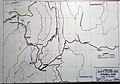
 Irrawaddy Watershed.gif 602 × 444; 49 KB
-
 Kanmaw Island relief.png 1,092 × 690; 1,015 KB
-
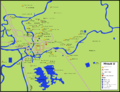
 KarteInleSee.png 777 × 1,659; 224 KB
-
 Konbaung 1767 Map 2.png 286 × 336; 35 KB
-
 Laos–Myanmar border.png 367 × 599; 88 KB
-
 Location of Chaung-U in map.png 258 × 543; 106 KB
-
 Location of Hydropower and Solar Power Plants in Myanmar.png 924 × 668; 458 KB
-
 Location of Thermal Power Plants in Myanmar.png 1,270 × 712; 514 KB
-
 Lower Myanmar districts Map.svg 1,052 × 1,275; 835 KB
-
 Major Sino-Tibetan groups.png 471 × 414; 16 KB
-
 Map - Mong Yang Town - Villages - 2048px.jpg 2,048 × 1,256; 295 KB
-

-

-

-

-

-

-

-

-

-

-

-

-

-

-

-

-

-

-

-

-

-

-

-

-

-
 Map by the US Army Map Service - NC 47-2 Bokpyin - burma - txu-oclc-6924198-nc47-2.jpg 5,000 × 3,771; 4.29 MB
-
 Map by the US Army Map Service - NC 47-6 Kra Buri - burma - txu-oclc-6924198-nc47-6.jpg 5,000 × 3,784; 4.48 MB
-
 Map by the US Army Map Service - ND 46-4 Ama - burma - txu-oclc-6924198-nd46-4.jpg 5,000 × 3,778; 3.79 MB
-

-

-
 Map by the US Army Map Service - ND 47-14 Mergui - burma - txu-oclc-6924198-nd47-14.jpg 5,000 × 3,787; 4.47 MB
-
 Map by the US Army Map Service - ND 47-2 Ye - burma - txu-oclc-6924198-nd47-2.jpg 5,000 × 3,798; 5.92 MB
-
 Map by the US Army Map Service - ND 47-6 Tavoy - burma - txu-oclc-6924198-nd47-6.jpg 5,000 × 3,798; 5.57 MB
-
 Map by the US Army Map Service - NE 46-12 Henzada - burma - txu-oclc-6924198-ne46-12.jpg 5,000 × 3,768; 6.34 MB
-
 Map by the US Army Map Service - NE 46-15 Sinma - burma - txu-oclc-6924198-ne46-15.jpg 5,000 × 3,806; 3.68 MB
-
 Map by the US Army Map Service - NE 46-16 Bassein - burma - txu-oclc-6924198-ne46-16.jpg 5,000 × 3,791; 6.06 MB
-

-
 Map by the US Army Map Service - NE 46-3 Kyaukpyu - burma - txu-oclc-6924198-ne46-3.jpg 5,000 × 3,791; 6.26 MB
-
 Map by the US Army Map Service - NE 46-4 Thayetmyo - burma - txu-oclc-6924198-ne46-4.jpg 5,000 × 3,799; 6.34 MB
-
 Map by the US Army Map Service - NE 46-7 Sandoway - burma - txu-oclc-6924198-ne46-7.jpg 5,000 × 3,795; 4.85 MB
-
 Map by the US Army Map Service - NE 46-8 Prome - burma - txu-oclc-6924198-ne46-8.jpg 5,000 × 3,789; 6.64 MB
-
 Map by the US Army Map Service - NE 47-1 Pyinmana - burma - txu-oclc-6924198-ne47-1.jpg 5,000 × 3,773; 6.58 MB
-
 Map by the US Army Map Service - NE 47-13 Rangoon - burma - txu-oclc-6924198-ne47-13.jpg 5,000 × 3,807; 5.37 MB
-

-
 Map by the US Army Map Service - NE 47-14 Moulmein - burma - txu-oclc-6924198-ne47-14.jpg 5,000 × 3,788; 5.92 MB
-
 Map by the US Army Map Service - NE 47-5 Toungoo - burma - txu-oclc-6924198-ne47-5.jpg 5,000 × 3,781; 6.58 MB
-
 Map by the US Army Map Service - NE 47-9 Pegu - burma - txu-oclc-6924198-ne47-9.jpg 5,000 × 3,816; 6.06 MB
-
 Map by the US Army Map Service - NF 46-10 Cox's Bazar - burma - txu-oclc-6924198-nf46-10.jpg 5,000 × 3,780; 5.69 MB
-

-
 Map by the US Army Map Service - NF 46-12 Myingyin - burma - txu-oclc-6924198-nf46-12.jpg 5,000 × 3,784; 5.48 MB
-
 Map by the US Army Map Service - NF 46-14 Akyab - burma - txu-oclc-6924198-nf46-14.jpg 5,000 × 3,774; 3.98 MB
-
 Map by the US Army Map Service - NF 46-15 Myohaung - burma - txu-oclc-6924198-nf46-15.jpg 5,000 × 3,773; 6.35 MB
-
 Map by the US Army Map Service - NF 46-16 Yenangyaung - burma - txu-oclc-6924198-nf46-16.jpg 5,000 × 3,811; 5.88 MB
-
 Map by the US Army Map Service - NF 46-3 Mawlaik - burma - txu-oclc-6924198-nf46-3.jpg 5,000 × 3,787; 6.21 MB
-
 Map by the US Army Map Service - NF 46-4 Wuntho - burma - txu-oclc-6924198-nf46-4.jpg 5,000 × 3,760; 6.11 MB
-
 Map by the US Army Map Service - NF 46-7 Gangaw - burma - txu-oclc-6924198-nf46-7.jpg 5,000 × 3,800; 5.92 MB
-
 Map by the US Army Map Service - NF 46-8 Shwebo - burma - txu-oclc-6924198-nf46-8.jpg 5,000 × 3,745; 5.67 MB
-
 Map by the US Army Map Service - NF 47-1 Mong Mit - burma - txu-oclc-6924198-nf47-1.jpg 5,000 × 3,755; 6.39 MB
-
 Map by the US Army Map Service - NF 47-10 Lai-Hka - burma - txu-oclc-6924198-nf47-10.jpg 5,000 × 3,775; 5.96 MB
-

-
 Map by the US Army Map Service - NF 47-13 Yamethin - burma - txu-oclc-6924198-nf47-13.jpg 5,000 × 3,798; 6.11 MB
-

-

-
 Map by the US Army Map Service - NF 47-5 Maymyo - burma - txu-oclc-6924198-nf47-5.jpg 5,000 × 3,786; 6.2 MB
-
 Map by the US Army Map Service - NF 47-6 Mong Yai - burma - txu-oclc-6924198-nf47-6.jpg 5,000 × 3,766; 6.24 MB
-
 Map by the US Army Map Service - NF 47-9 Mandalay - burma - txu-oclc-6924198-nf47-9.jpg 5,000 × 3,793; 6.09 MB
-

-

-
 Map by the US Army Map Service - NG 46-16 Paungbyin - burma - txu-oclc-6924198-ng46-16.jpg 5,000 × 3,798; 5.67 MB
-
 Map by the US Army Map Service - NG 46-8 Sibsagar - burma - txu-oclc-6924198-ng46-8.jpg 5,000 × 3,771; 5.46 MB
-
 Map Myanmar.png 300 × 660; 380 KB
-
 Map of Andaw.jpg 3,024 × 4,032; 2.53 MB
-
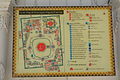
 Map of Mandalay Palace.jpg 4,032 × 3,024; 4.68 MB
-
.png/120px-Map_of_Maungdaw_District_in_Rakhine_State_(Arakan).png) Map of Maungdaw District in Rakhine State (Arakan).png 600 × 990; 31 KB
Map of Maungdaw District in Rakhine State (Arakan).png 600 × 990; 31 KB
-
-
 MapMraukU.png 2,321 × 1,780; 623 KB
-
 MapMraukU.svg 1,500 × 1,500; 255 KB
-
 MapNgapaliBeach.svg 524 × 744; 92 KB
-
 MerguiArchipelagoMap.png 973 × 1,808; 61 KB
-
 Mi Lan.jpg 600 × 502; 21 KB
-
 Myanmar adm location map numbered.png 1,242 × 2,040; 606 KB
-
 Myanmar administrative divisions by & of forest cover.png 2,999 × 2,290; 449 KB
-
 Myanmar Crown Colony Scheme.svg 1,081 × 2,364; 83 KB
-
 Myanmar Dry Zone Townships.svg 1,052 × 1,169; 3.37 MB
-
 Myanmar OpenStreetMap Road tagging version 20240531.png 927 × 793; 61 KB
-
 Myanmar Panhandle.svg 8 × 20; 10 KB
-
 Myanmar regions by HDI.png 693 × 893; 72 KB
-
 Myanmar Solar Power Project 2020.svg 385 × 797; 1.19 MB
-
 Myanmar-Divisions and States.png 255 × 498; 63 KB
-
 Myanmar-outline-map.png 240 × 350; 7 KB
-
.jpg/120px-Myawaddy_street_(cropped).jpg) Myawaddy street (cropped).jpg 2,592 × 439; 887 KB
Myawaddy street (cropped).jpg 2,592 × 439; 887 KB
-
 Myitsone and nearby Projects.png 470 × 652; 524 KB
-
 PacificTheaterAug1942.jpg 1,199 × 873; 256 KB
-
 Path5215-4-1-1-13-8-6-4.png 3,570 × 3,708; 969 KB
-
 Pathein district map.jpg 1,087 × 1,566; 1.76 MB
-
 Pegu map.jpg 1,395 × 1,022; 1.74 MB
-

-
 Phangsang.jpeg 721 × 845; 42 KB
-
 Power Plants in Myanmar.svg 512 × 1,106; 1.2 MB
-
 Refugee and Resettlement Sites along Thai-Burma Border.jpg 1,208 × 1,880; 525 KB
-
 Reversed Map of South Asia.gif 2,000 × 2,156; 2.18 MB
-
 SAZs & SAD of Burma.png 283 × 592; 25 KB
-
 SAZs & SAD of Myanmar - ru.svg 841 × 1,759; 178 KB
-
 Shwedagon Pagoda 3.JPG 6,000 × 4,000; 11.88 MB
-
 Stillwell road map usarmy.jpg 3,617 × 2,520; 1.88 MB
-
 Terremoto birmania.jpg 612 × 718; 133 KB
-
 Terremoto de birmania de abril de 2016.jpg 612 × 718; 147 KB
-
 Text3305-6-7-7.png 4,394 × 4,926; 853 KB
-
 Thantlangmap.png 748 × 1,364; 163 KB
-
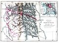
 Thayet-District-Burma-2010.png 1,313 × 888; 210 KB
-
.png/60px-The_map_of_Lower_Burma_(1853).png) The map of Lower Burma (1853).png 1,200 × 2,520; 627 KB
The map of Lower Burma (1853).png 1,200 × 2,520; 627 KB
-
.png/60px-The_map_of_Upper_Burma_(1885).png) The map of Upper Burma (1885).png 1,200 × 2,520; 633 KB
The map of Upper Burma (1885).png 1,200 × 2,520; 633 KB
-
 Two Geopolitical Regions of Myanmar.png 653 × 980; 260 KB
-
 Txu-oclc-10552568-nf47-3.jpg 5,000 × 3,790; 5.6 MB
-
 Wa state.png 595 × 1,280; 44 KB
-
_(page_178_crop).jpg/120px-thumbnail.jpg)
-
 Zawtika Martaban Myanmar.jpg 430 × 250; 166 KB
-
 ミャンマーにおける一次金鉱床と砂金の分布図.jpg 1,045 × 2,057; 139 KB
-
 ミャンマーの主要鉱床分布図.jpg 827 × 1,131; 76 KB
-
 孟国.jpg 3,306 × 2,859; 3.15 MB
-
 緬甸若開人分布圖.jpg 717 × 1,280; 48 KB
-
 阿瓦王朝.jpg 4,127 × 8,245; 3.54 MB
-
 阿瓦王朝1370.jpg 4,127 × 6,932; 6.06 MB


